Easier/Medium Difficulty![]()
![]()
Distance (return)
0.6km / 0.4mi
(Shorter route)
5km / 3.1mi
(Longer route)
Approx. time
45 mins return (shorter)
2 hrs return (longer)
Elevation gain
46m / 150 ft (shorter)
36 m / 118 ft (longer)
More details
Steepest grade: Some steeper sections
High-clearance 4×4 advised to trailhead? No
Best seasons: Year-round
Closest public bathroom Outhouse at parking lot
Cell service? No
Gear to bring Bring 0.5L water per person and bug spray
Trail Description:
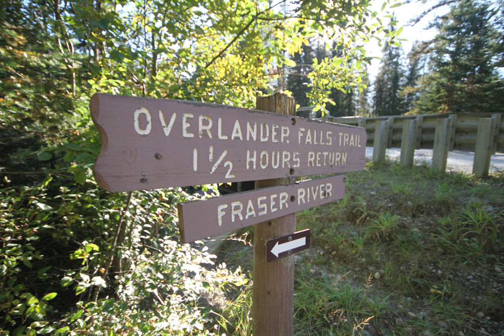
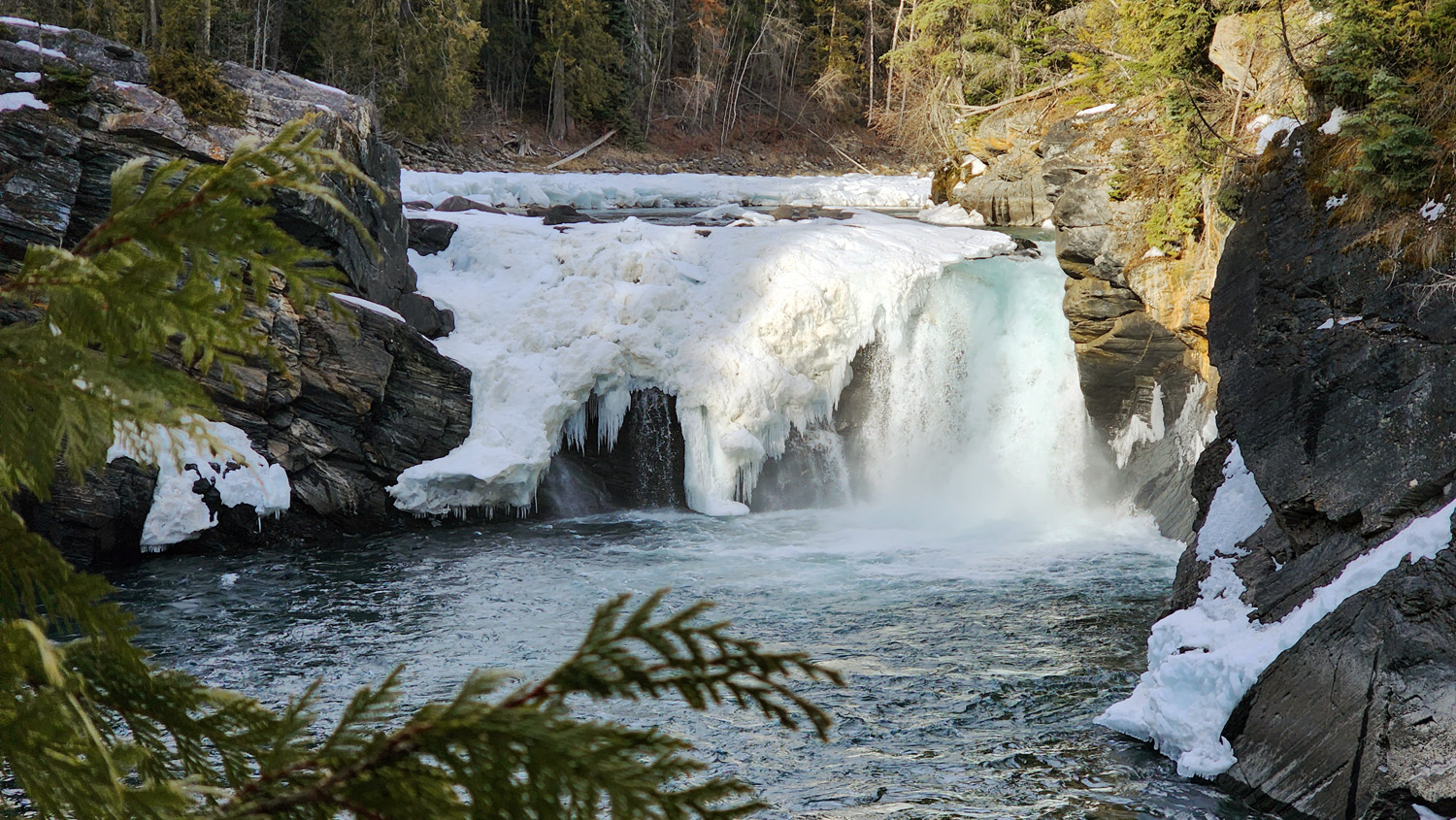
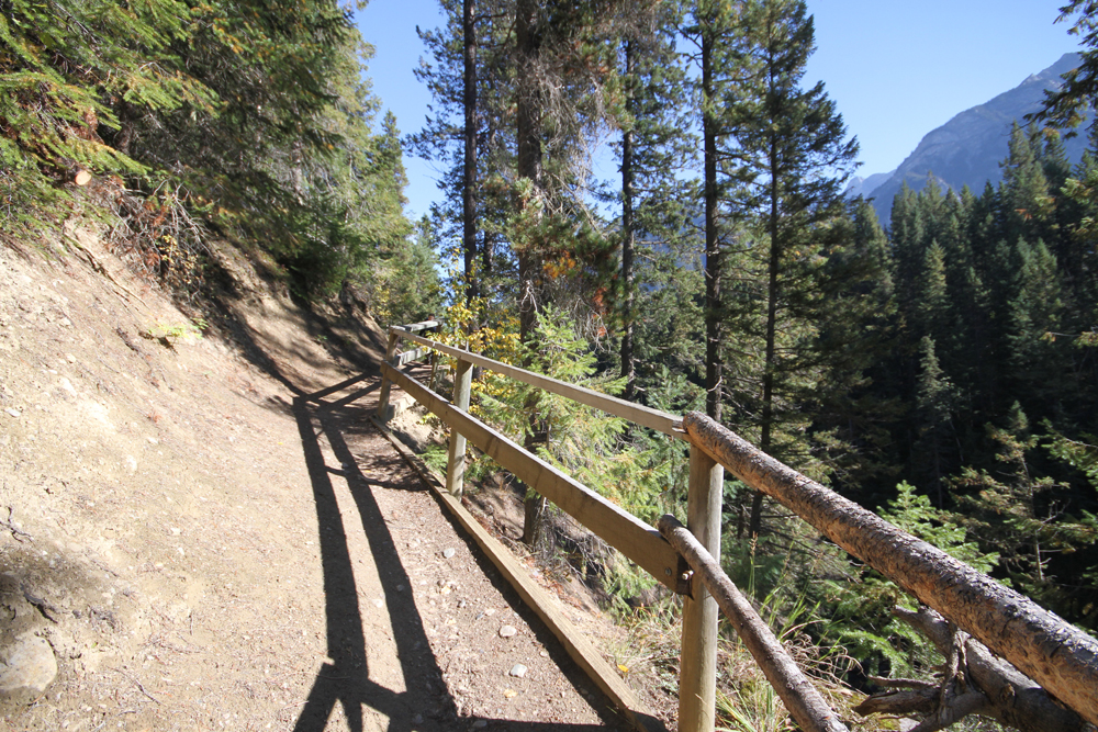
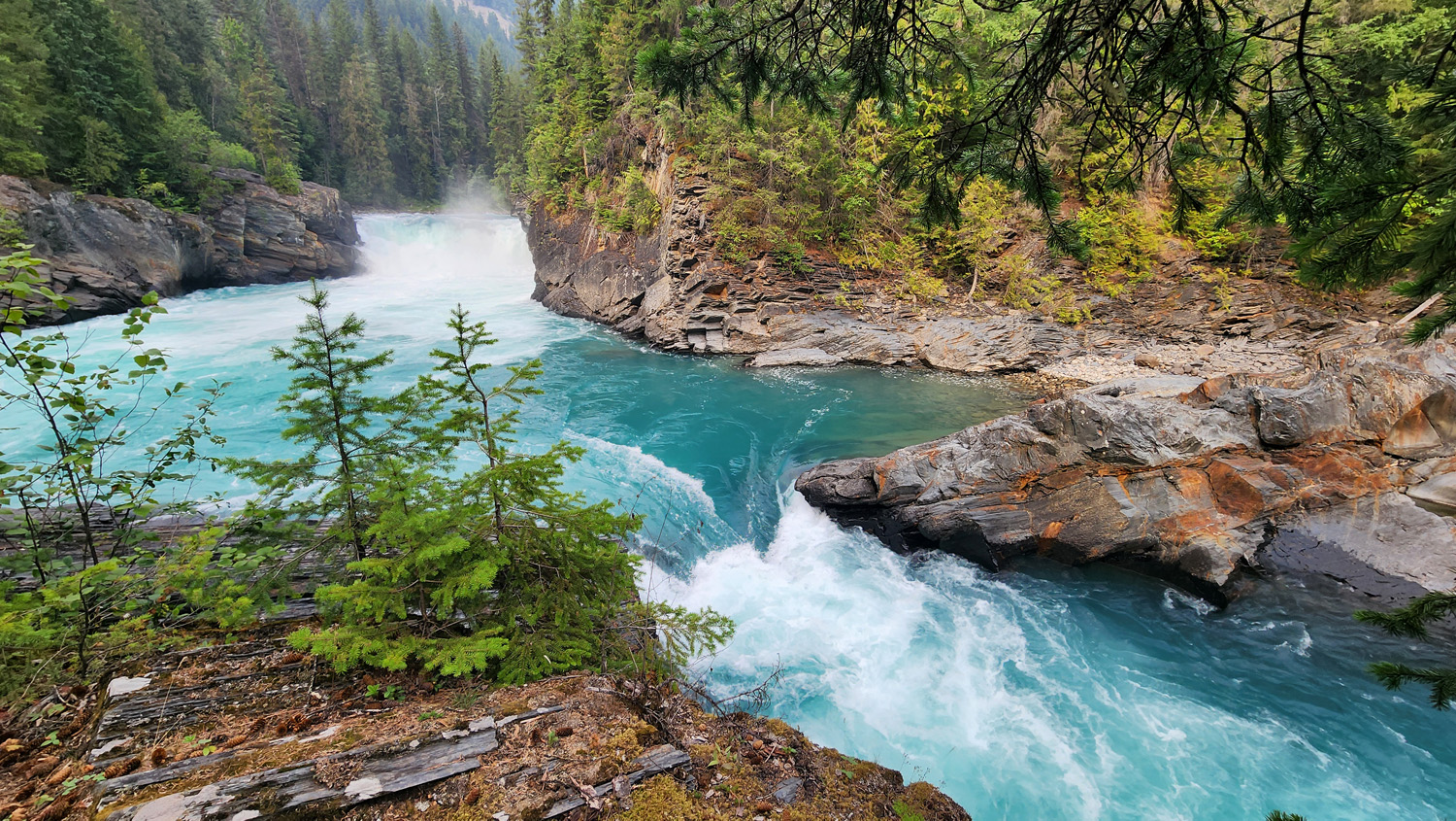
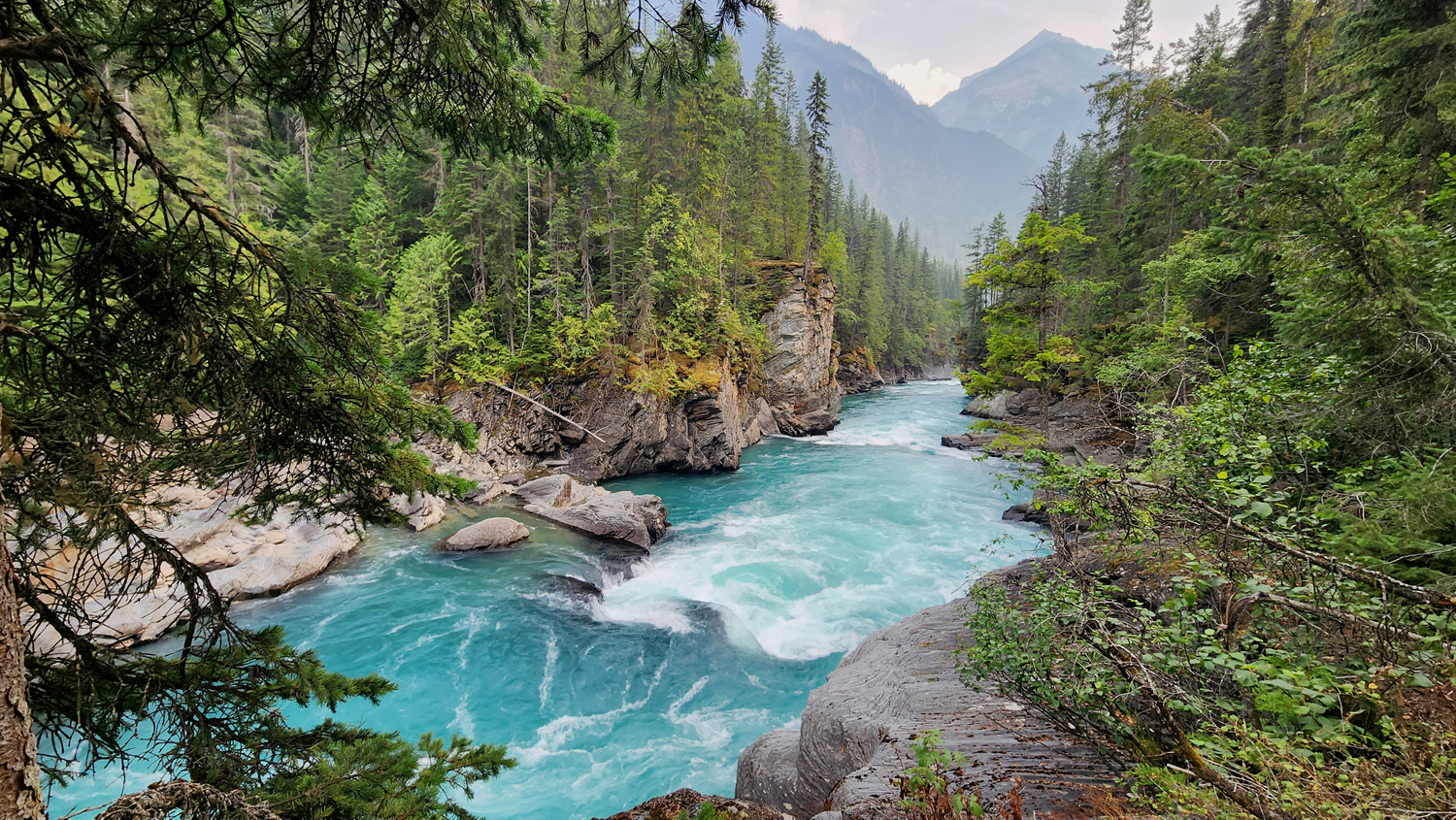
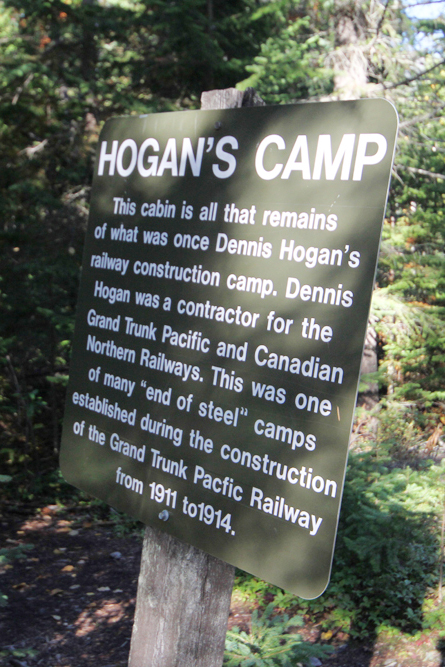
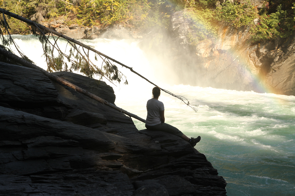
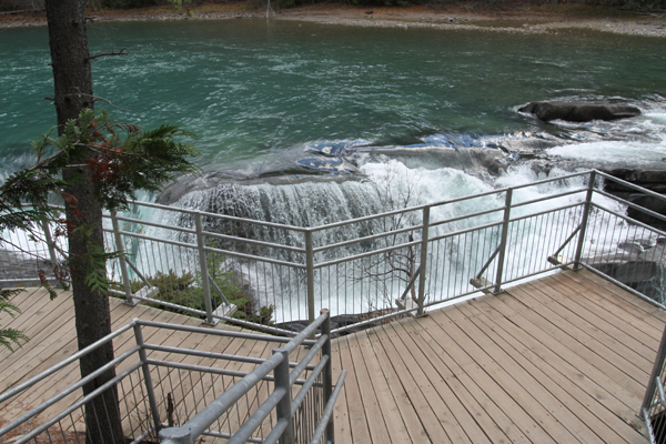
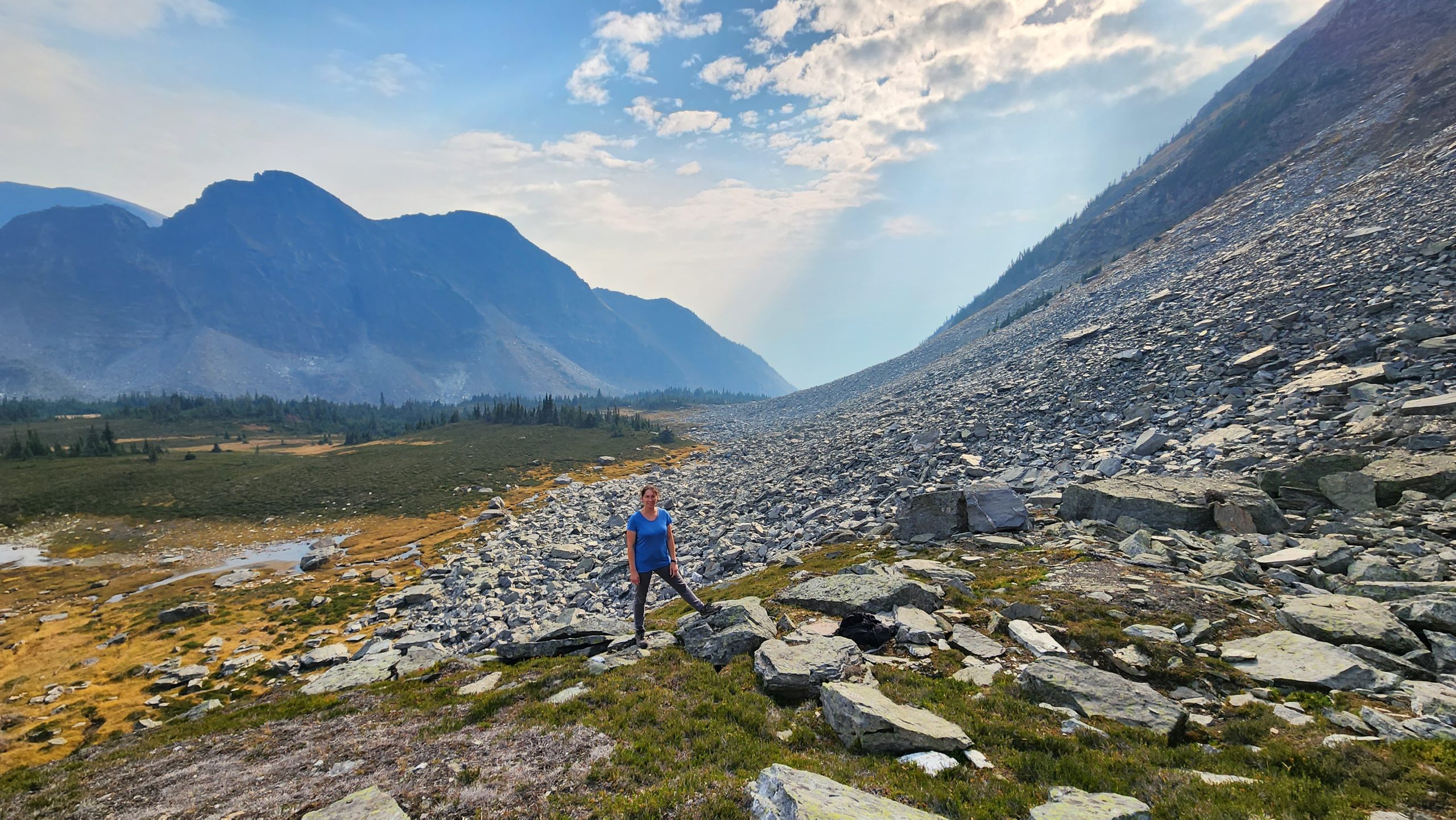
This is a gentle hike with two different routes to the falls. The longer trail follows the Fraser River and gives way to several beautiful views of the canyon below. You’ll also discover the historic Hogan’s Cabin along this trail. This hike is a perfect short hike if you’re exploring Mt. Robson and you’ve already done Kinney Lake. On the longer trail there are some narrow sections that drop off steeply and would not be good for someone with a severe fear of heights. Bring bug spray.
Best Parts: This is a gentle hike with two different routes to the falls. The longer trail follows the Fraser River and gives way to several beautiful views of the canyon below. You’ll also discover the historic Hogan’s Cabin along this trail. This hike is a perfect short hike if you’re exploring Mt. Robson and you’ve already done Kinney Lake.
Worst Parts: On the longer trail there are some narrow sections that drop off steeply and would not be good for someone with a fear of heights or balance issues. The path also sometimes contains exposed roots that are a tripping hazard. The mosquitoes are bad during the summertime, but nothing a little mosquito spray or net shirt can’t handle.
How to access/where to park
Google Map Directions
(shorter hike trailhead)
From Valemount, head north of Hwy 5 for 19km. Merge onto Hwy 16E (towards Jasper). Continue to Mt. Robson approx. 18km. Look for the Overlander Falls trailhead sign on the highway (past Mt. Robson) or turn into the Robson Meadows Campground (across from info centre) for the longer 2.5km hike (one-way) to the falls. The parking area here is just before the bridge. The trailhead is on the opposite side; there’s a sign amid the bushes.
Trailhead coordinates:
(parking 1) 53.031226°, -119.208004°
(parking 2) 53.028177°, -119.230594°
(Insert into GPS or Google Maps search bar)
GPS Tracks
(Right click, Save link as)
Download Trail GPX file

 Add to favorites