Hard Difficulty![]()
Distance (return)
8.4 km/
5.2 mi
Approx. time
6–8 hrs return
Elevation gain
2625 ft/
800 m
* There may be active logging on the access road.
More
Details
Steepest grade: 30%+
High-clearance 4×4 advised to trailhead? Yes
Best seasons: late June to late Sept
Closest public bathroom Horse Creek campground at the bottom of the access road.
Cell service? Spotty
Gear to bring Bring 2L water per person, bear spray and bug spray
Trail Description:
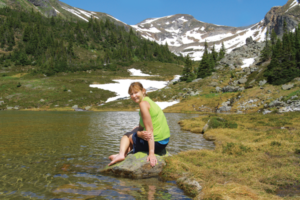
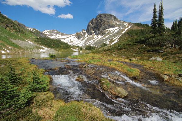
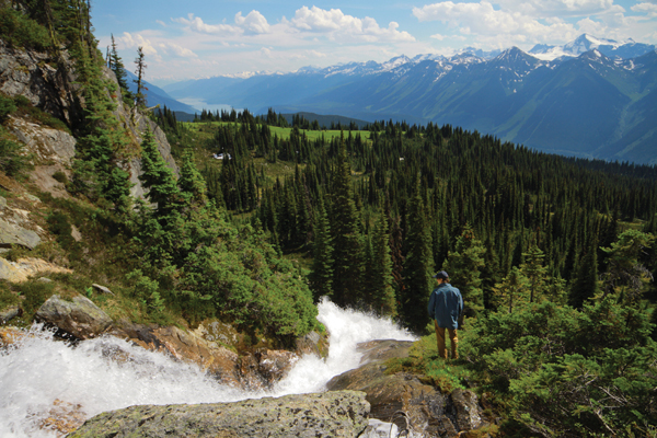
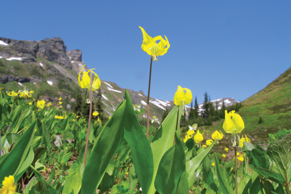
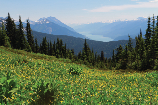
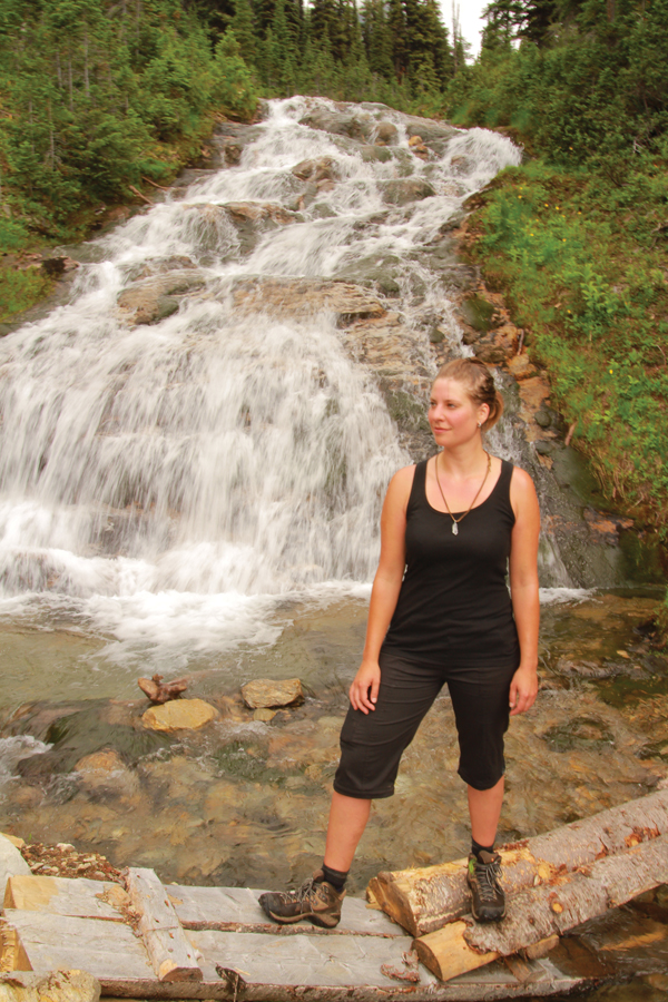
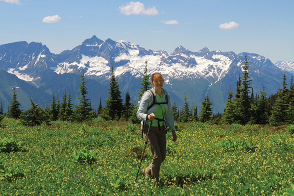
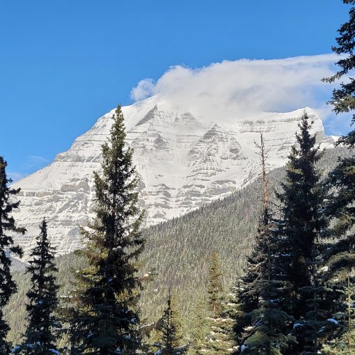
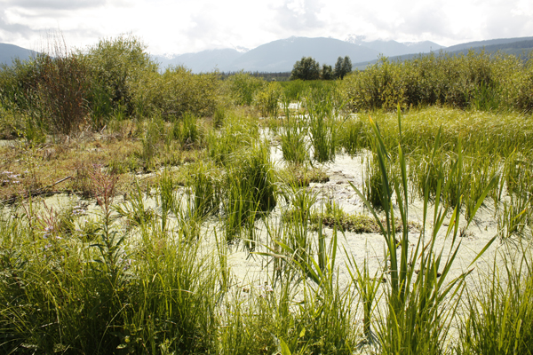
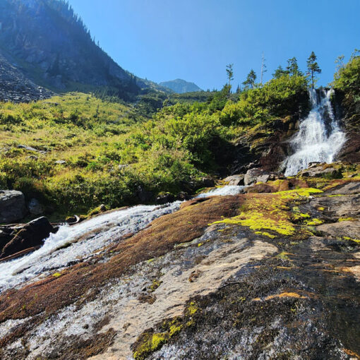
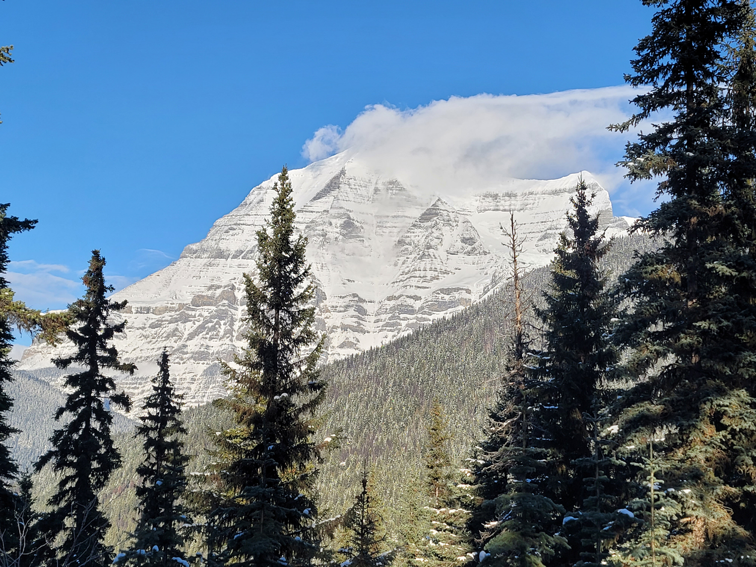
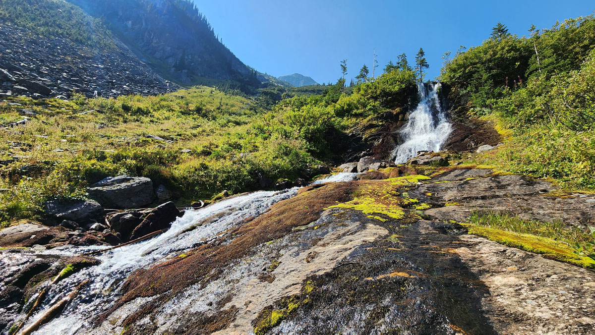
The Lily Meadows Hike (aka Bulldog Ridge Trail) is a scene out of the Sound of Music late June to early July. For centuries, bulb-digging grizzlies have cultivated yellow glacier lilies. Here and there you’ll see freshly turned earth – evidence of a bear’s busy paw. Even if you miss the lily explosion, beyond the meadows, you’ll discover a turquoise lake as you climb up and get closer to the Horse Creek headwaters. High above, you may see a hawk or osprey circling slowly. Beyond the lake are more views, but most hikers turn around here. Rather than backtracking, you can follow the lake west where the water flows down a cliff. The waterfall isn’t huge, and nimble hikers can stand next to where it drops and get an unparalleled view of Kinbasket Lake. The descent is very steep, however, and you have to pick your way down another rockslide just beyond the waterfall. The trail here is not ribboned and it’s easy to lose your way. The descent follows Horse Creek closely until it meets up with the old better-tread trail. A GPS device is useful here.
Best Parts: There’s something for everyone – mountain top views, alpine flowers, meadows, huge bluffs, waterfalls, alpine lakes and more!
Worst Parts: There are some very steep, rocky sections that are slippery when wet and it’s hard to grip unless you’re wearing good hiking shoes. The bottom trail becomes very soggy during wet weather. Hiking poles, good shoes and caution are recommended for these sections, as they become extremely slippery. Be sure to make lots of noise so you don’t surprise any bears and they have time to leave to avoid an encounter. The mosquitoes and flies are bad during the summertime.
How to access/where to park
Google Map directions to base of LOGGING road
(trailhead is further up road)
In a high clearance vehicle, travel south on Whiskey Fill Rd to Canoe Forest Service Rd. Turn left onto that road and drive 20 km (there are km markers along the way). Head towards the marina and campgrounds (stay to the right at any forks). Past the marina, you’ll hit two forks, keep left at both. Follow this next logging road ~8 km until you hit a bridge over a small creek. Park next to the bridge, to the side so traffic can pass. WARNING: there’s often active logging here. Proceed with caution, carry a radio and obey call signs.
Trailhead coordinates
52.666797°, -118.974782°
(Insert into Google Maps or GPS)
GPS Tracks
(Right click, Save link as)
Access Road GPX file
Meadows & Lakes Trail GPX

 Add to favorites