Medium/Hard Difficulty![]()
![]()
Distance (return)
12 km/ 7.4 mi (cabin)
20 km / 12.4 mi (ridge)
Approx. time (return)
3-4 hrs (cabin)
4-5hrs (ridge)
Elevation gain
500 m/1640 ft (cabin)
700 m/2300 ft (ridge)
NOTE: Visiting the cabin before climbing to the ridge increases the elevation gain to 1000m due to undulating terrain
More Details
Steepest grade: ~20%+
High-clearance 4×4 advised to trailhead? Not usually
Best seasons: Summer & fall (in winter, cabin used for backcountry skiing)
Closest public bathroom Outhouse at cabin
Cell service? Spotty
Gear to bring Bring 3L water per person and bug spray. Hiking poles are useful for the descent.
Trail Description:
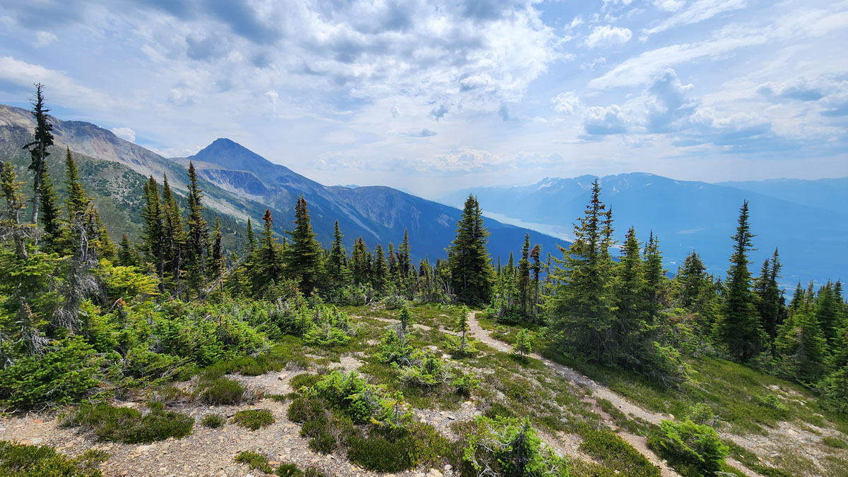
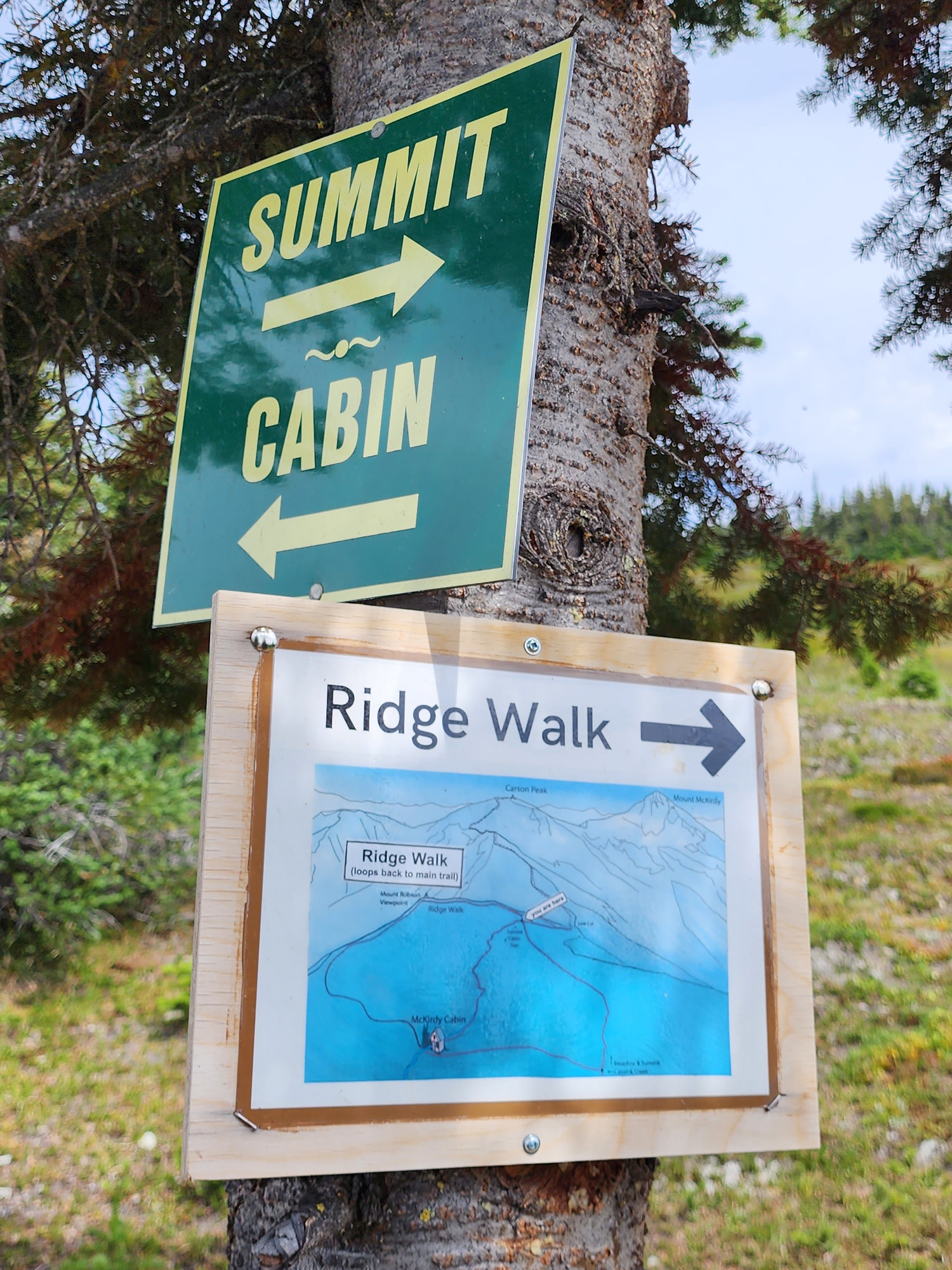
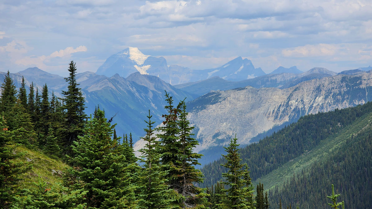
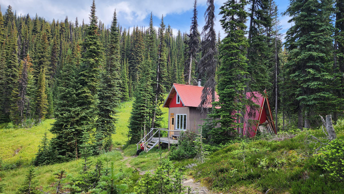
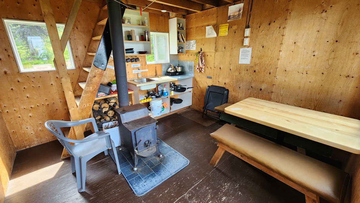
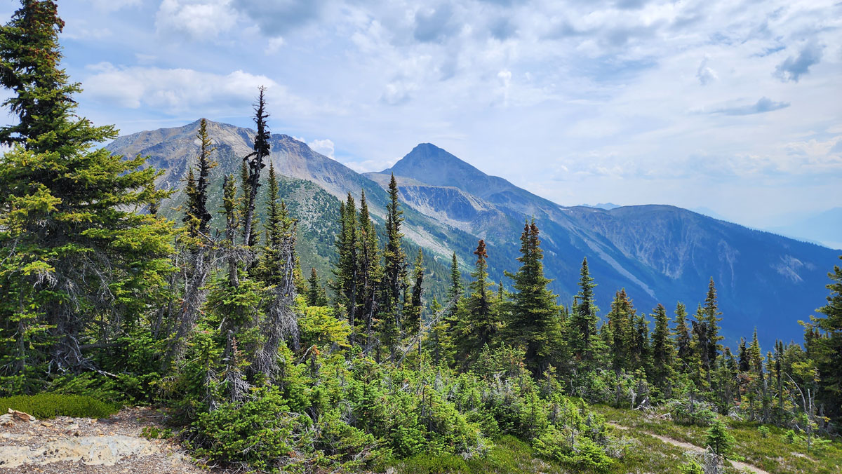
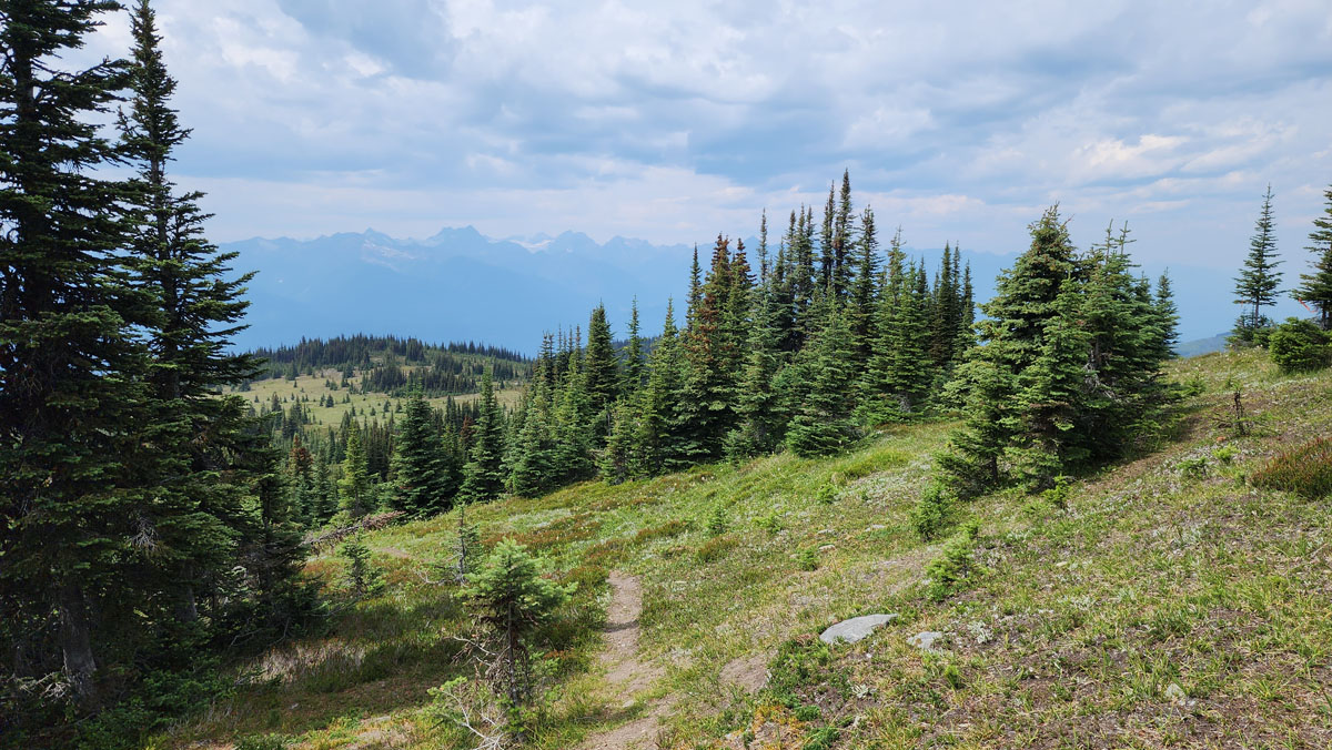
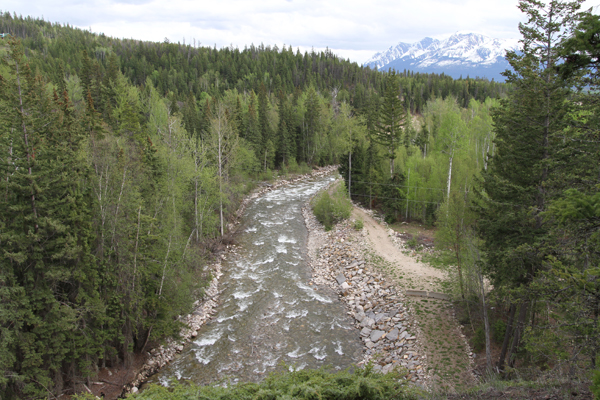
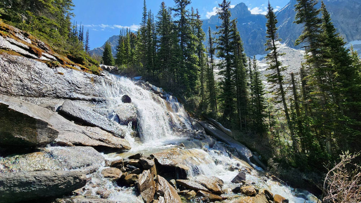
The McKirdy Meadows Trail is a great choice to get into the alpine! The 6km trail traverses mixed forest with viewpoints of Valemount and Kinbasket Lake along the way. In the subalpine watch for signs to the McKirdy Meadows and the YORA Cabin (note: the creek by the cabin is the only water source). From this junction, the main trail continues across the meadow to another junction where one has four options: 1. Backtrack the way you came (shortest) 2. Take the left fork which swings by the cabin and then back to the main trail junction. 3. Continue up to a nice ridge which leads to a lovely view of Mt Robson and also swings by the cabin and back to the main trail. 4. Take the right fork which drops down to the col where you have the option of continuing up to Carson’s Peak (sub peak of Mt McKirdy) with an elevation gain of 450 metres. For those with mountaineering/route finding experience, the Mt McKirdy summit is a rewarding option (note: watch for loose rocks on final approach to summit).
Best Parts: Incredible views and a relatively short hike to alpine. Option of staying overnight.
Worst Parts: Bears are sometimes spotted. Make noise so you don’t surprise them. The mosquitoes are bad starting as early as mid-May and continuing until mid-summer. Bring bug spray and a netshirt/pants and avoid hiking at dusk. The alpine flies can also be pesky.
How to access/where to park
Google Maps directions
You can access this trail from near the top of 5-Mile Road. There is a small parking area off the road. When dry, this road is usually fine for all types of vehicles, though the way down can sometimes be hard on automatic breaks.
The maximum grade of this road is approx. 15%.
Trailhead coordinates
52.848831°, -119.218285°
(insert into Google Maps search bar or GPS)
GPS Tracks
(Right click, Save link as)
Download Trail GPX file

 Add to favorites